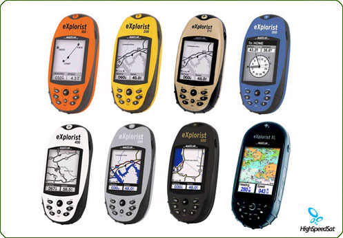
Magellan eXplorist GPS are handheld GPS systems for walkers, hikers, bicyclist.
Beyond the vibrant blue, orange and yellow exteriors is a GPS device that is built for serious outdoor use. With a tough, impact-resistant, waterproof exterior and a simple operating system, you�ll love the eXplorist. Each Magellan� eXplorist� model offers advanced capabilities, including Magellan TrueFix technology, which incorporates a superior 14-parallel-channel, WAAS/EGNOS-enabled GPS receiver to provide precise position fixes within 3m and ensure advanced reliability and accuracy in satellite signal acquisition and tracking. One-button access quickly takes you directly to the functions that matter most: the menu, navigation screens, personal points-of-interest storage, �go to� routing and the backlight.
In addition, each eXplorist model stores up to 500 waypoints, 20 routes and multiple track logs with up to 2000 points each! Designed for compact, fit-in-your-pocket convenience, eXplorist receivers measure only 4.6"H x 2.1"W x 1.3"D and weigh less than 4 oz., yet they provide a large 2.3" diagonal, four-level grayscale LCD. The zoom capability and amber backlighting ensure optimum viewing even at night.

eXplorists Magellan
handheld GPS![]()
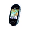
The rugged exterior is wrapped in a rubber armored, impact resistant casing that is waterproof. The eXplorist 100 offers the best value in a GPS/track plotter. Small, lightweight and easy to use, anyone can pick it up and get going without studying a manual. The eXplorist 100 offers three navigation screens with track plotting to help you find your way there and then find your way back.
Adding to the features of the eXplorist 100, the eXplorist 200 gives you a built-in North American background map and the ability to save up to five track-log files, each with up to 2000 points. The background map offers convenient access to roads, parks, waterways, airports and more.
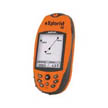
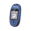
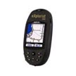
The Magellan - explorist 100 satellite handheld GPS unit is powerful, affordable GPS with track-plotter. Explorist-100 provides reliable accuracy to within 3 meters. Save track logs to guide you to your favorite spots. Back Track will lead you to camp, the car and home. More about eXplorist 100 ...
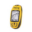
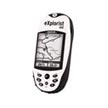
Featuring TrueFixTM technology for reliable accuracy to within 3 meters, built-in maps and customizable screens make navigating the outdoors fun and easy. Save track logs, waypoints and more to 8 MB free memory. Powerful, affordable and easy to use. More about eXplorist 200 ...
An incredible value: 22 MB of available memory, USB port and MapSend compatibility for topo or street navigation. Large backlit display and customizable navigation screens show your GPS information the way you want it. Easy-to-use keypad and joystick. More about eXplorist 210 ...
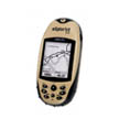
Advanced features at an incredible value. Barometric pressure altimeter and thermometer offer reliable elevation and an advance on changing weather. Electronic compass shows your direction, even when standing still. Save track logs and more. More about eXplorist 300 ...
Powerful, expandable, pocket-sized mapping GPS. SD-card expandability and USB port offer unlimited map, waypoint and track log storage. Geocache Manager enables easy download and use of coordinates from Web sites. Perfect for active outdoor adventures. More about eXplorist 400 ...
The eXplorist 500 offers all the great GPS features and functions. High-speed USB port and unlimited SD card data storage make it easy to add detailed maps, for topo, marine or street navigation. Save track logs and more to 8 MB free memory. More about eXplorist 500 ...
The most advanced features include color screen, 3-axis electronic compass, barometric pressure altimeter and thermometer. Add MapSend� topographic and street-routing software with USB data port and SD-card compatibility for unlimited storage. More about eXplorist 600 ...
The 3.5" color display is the largest of any rugged outdoor GPS. A remarkable 30 MB available memory, SD card expandability, plus high-speed USB data port and MapSend� map compatibility make your eXplorist XL the ultimate multi-use GPS. More about eXplorist XL ...

eXplorists
Magellan
handheld GPS ![]()
The eXplorist 400 features an internal 8 MB base map of North American roads, parks and waterways and will calculate area. Plus the memory can be expanded using SD cards for maps or for track log files. There are four navigation screens to use and a lithium-ion rechargeable battery.
The eXplorist 500 has all the features of the eXplorist 400, but with a full-color screen. It also has a USB data port for faster transfer of map data from your PC to your GPS unit.
The eXplorist 600 adds in all the features of the eXplorist 400 and 500, but adds in all of the extras needed to have a complete unit. The 600 has a three-axis compass, so the compass will display no matter the angle at which the unit is being held. There is also a barometric altimeter, barometer and thermometer. The 600 also has a color screen and unlimited expandable memory.
Satellite GPS Forum - Have a question? Post it here.
Satellite GPS Blog - Comment the latest news and info from satellite GPS arena


